Showing posts with label Earthquakes. Show all posts

Saturday, June 11, 2022

When Sky and the Earth Wreak Havoc

Worst Natural Disasters in History 

by Martha Rogers


I've been through many storms from hurricanes to tornadoes to floods, and they have always fascinated me and had me thinking about the results left behind. Our country has seen many natural disasters caused by what insurers call "An Act of God."

When a weather pattern forms circles with a low-pressure center, whether rotating clockwise or counterclockwise, it is technically known as a cyclone. This includes hurricanes and tornadoes as well as larger systems such as a middle-latitude cyclones. Hurricanes and typhoons are two names for the same type of storm--a strong tropical cyclone. The names are interchanged in various areas of the world. Today, we look at some of the greatest ones in history before 1950.

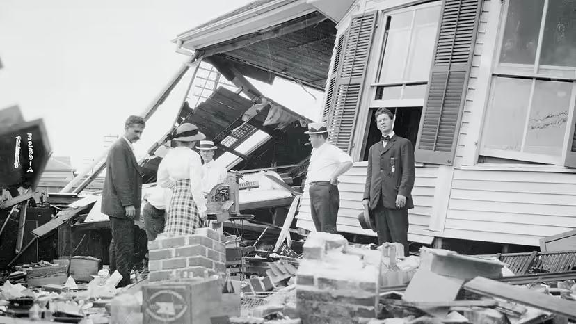
Several years ago I did an entire blog on the Galveston hurricane that devastated the island and caused hundreds of death. It happened before hurricanes had names and is simply known as the Galveston Hurricane of 1900. It hit shore and became the deadliest storm to hit on American soil in history with 140 MPH winds and fifteen foot waves. Estimates of deaths ranged between 8,000 and 10,000 people killed. Even a year later, bodies were found washed ashore. 


Since then, hurricanes have hit the Gulf and Atlantic coast lines from deep South Texas to both coasts of Florida and up the Atlantic coast on up to Canada. Meteorologists refer to hurricanes as the most deadly storms to hit land. Because of the length of time they take to move through an area and how long they can last, death tolls and destruction runs high.

Most of us remember the more recent ones from Carla, to Camille, to Katrina, Rita, Ike, Sandy, Andrew to name a few. The damage from a hurricane can be as devastating today as it was over a one hundred years ago. Now, the National Weather Service can be much more accurate in their predictions of where the storms will make landfall, how large they are and how fast the winds are.

Most of remember the tornado featured in The Wizard of Oz. That fictional storm took place in Kansas. In reality, Kansas, Missouri, Oklahoma and other mid-west plains states are in the heart of tornado country and what has been called "Tornado Alley." 


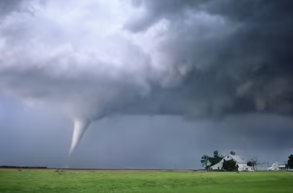
Of all the destructive power of storms, none have the ferocity and form of tornadoes. They come down like a sword from the sky and lash out at their surroundings as though with malicious and mindful intent to destroy. These columns can reach speeds of over 300 mph and measure from a mile to many miles across. They scar the earth and destroy homes and buildings in brief moments of twisting and turning in their fury. 

They year 1925 saw such a storm rage across the mid-west bringing destruction to towns across three states from Missouri to Illinois and into Indiana. The


distance was 219 miles and the tornado traveled it in about three and half hours. Because of the straight path for 183 miles, scientists believe it might have been a family of tornados spawned by a massive supercell storm. It is one of the deadliest and most destructive tornadoes to hit the mid-west states.

In March of1888, a hurricane on the Atlantic coast came ashore as a blizzard that devastated states along the upper coast. Known as the Great White Hurricane, it immobilized cities such as New York with the amount of snow that fell. It paralyzed the East Coast from the Chesapeake Bay to Maine and on up to the Canadian Atlantic coast cities.


Brooklyn, New York in March, 1888

The snow piled high in the streets and kept people indoors for several days. Damage to spring crops like the apple trees in Connecticut ran high, and loss of life. Property damage ran to more than $20 million and 400 lives were lost, include 100 sailors across the east coast. 

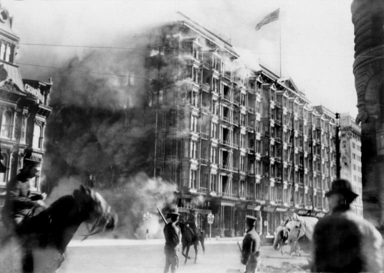
Other natural disasters which took hundreds of lives and caused millions in property damage include the great earthquake in San Francisco. 
This massive earthquake occurred the morning of April 8, 1906 and took the lives of 3,4400 people and destroyed close to 80% of the city. The quake lasted only a minute, but firefighters spent four days putting out fires. Thousands were left homeless and lived in tents.

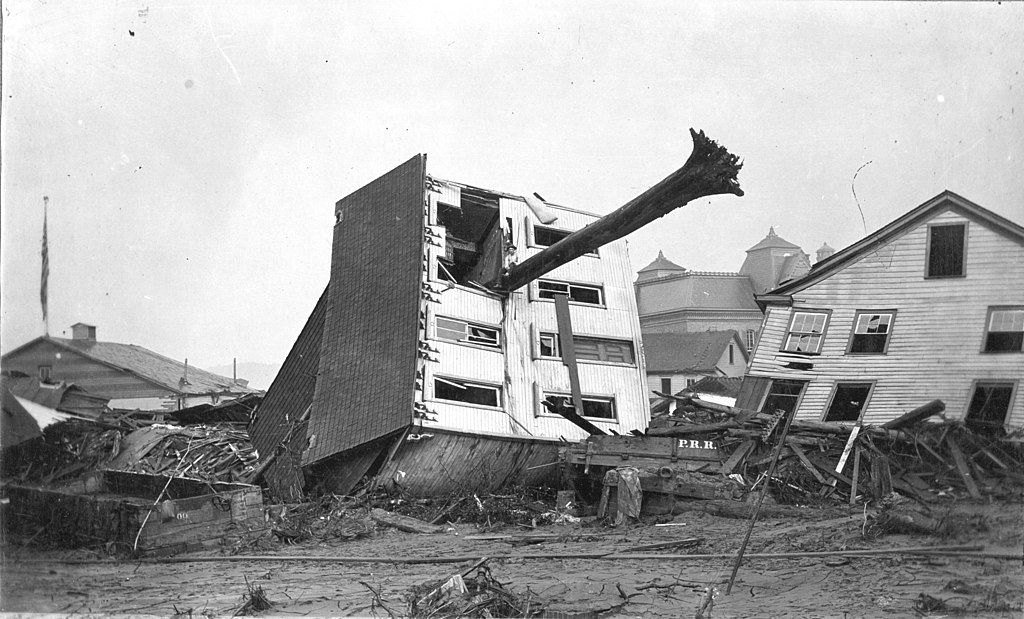
The Johnstown Flood is also listed with the top natural disasters and was the first one attended to by the American Red Cross. It became crucial in the history of natural disasters because of the lack of disaster and crisis management. A combination of heavy rain and a dam break sent 20 million gallons of water into the Mississippi River. This surge of water created a 70 foot high wave of water that traveled over fourteen miles on May 31, 1889. It destroyed everything and everyone in its path.

This is the John Schultz home in Johnstown. As it floated away down the street, a tree skewered it. Miraculously, the six people inside the home survived.

Tsunamis, volcano eruptions, typhoons are other acts of nature that wreak havoc over the land and sea. We can be thankful today for the Natural Weather Service which can warn us of such storms and disasters and allow us to find shelter and safety.

I have featured storms in several of my books. The Great White Blizzard is featured in my book Summer Dream. Have you ever been through a strorm that left behind destruction and/or death? Comment below and leave your email address for a chance at a free copy of this book.

Rachel Winston is the daughter of a minister in Briar Ridge, Connecticut. 
When a friend of her best friend's brother comes to visit, Rachel is attracted to him, but Nathan Reed wants nothing to do with a Christian, much less the daughter of a minister because of tragedy in his own family that caused him to turn from God.

After he is caught in a blizzard and nearly dies, the ministries of Rachel and her mother show him the true meaning of God's love. Now he must make amends with his family for his past and pray that Rachel will wait for him.


Martha Rogers is a multi-published author and writes a weekly devotional for ACFW. Martha and her husband Rex live in Houston, Texas where they are active members of First Baptist Church. They are the parents of three sons and grandparents to eleven grandchildren and great-grandparents to six. Martha is a retired teacher with twenty-eight years teaching Home Economics and English at the secondary level and eight years teaching Freshman English at the college level. She is a member of ACFW, ACFW WOTS chapter in Houston, and serves as President of the writers’ group, Inspirational Writers Alive.  


Friday, April 8, 2022

Where were the largest earthquakes in the continental United States? (Hint--not San Francisco)

by Martha Hutchens

Every now and then, a community has a terrible day. Or in this case, a terrible five months. 

Deposit Photos
Our story starts in New Madrid (pronounced MA-drid), Missouri on December 16, 1811, a small town on the Mississippi River, about 150 miles south of St. Louis. At 2:00 am, many of its 3000 residents were thrown out of their beds when the earth started shaking. The combination of horizontal and vertical motion made the ground roll like ocean waves. Thunder and lightning accompanied the movement, but it came from the ground, not the sky. Fissures opened, geysers spewed sand high into the air, and a sulfurous smell pervaded the area. By 7:00 a.m., a full 27 separate shocks had hit the area, before an aftershock nearly as strong as the first hit.

In the nearby town of Little Prairie, near present-day Caruthersville, the town itself and most of the surrounding land sank, to be inundated by the Mississippi River. The residents who waited until dawn to evacuate faced trekking eight miles through waist-high water.

And this was only the beginning. On January 23, 1812 and February 7, 1812, two more major earthquakes rocked the area. While estimates of the strength of these quakes vary widely, the December quake may have been as strong as 8.1 on the Richter scale. The “hard shock” in February has estimates as high as 8.8, which would put it on the list of top ten earthquakes of all time. Since the Richter Scale is logarithmic, the February shock would have been close to ten times stronger than the first earthquake in December.

Barge on the Mississippi River--Deposit Photos
The Mississippi River was (and is) a major waterway for barge traffic, but the river was no place to be during these quakes. The ground under the river shook, creating roiling waves. The banks fell into the river, and during at least one of these quakes the river ran backward due to a fissure opening upstream and water rushing backward to fill it. During the third earthquake, a waterfall appeared briefly on the Mississippi near New Madrid. Thirty boats went over these falls; twenty-eight of them sank.

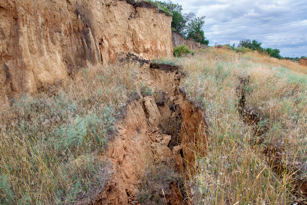
During the five months around these earthquakes, the area experienced over 2000 earthquakes. Stop and think about that for a minute. That’s 400 earthquakes a month. Thirteen earthquakes a day. An earthquake every TWO HOURS. During many of these quakes, fissures opened. Some were only a few feet deep and a couple of dozen feet long, but some extended for miles. Some fissures closed nearly as soon as they opened, some closed after a few hours, but some remained until filled by nature. A few fissures measured 12 feet deep in 1912—100 years after their formation. 

Fissure--Deposit Photos
Residents of the area noticed that most fissures opened southwest to northeast, so many cut down trees perpendicular to this path. At the first sign of a tremor, they ran to the felled tree and climbed on top of it. There are records of at least a handful of people having a fissure open beneath the tree, and crediting the tree for saving their life. It is believed that the earth literally swallowed a handful of missing people during these quakes. One woman who lived near the Pemiscot River exited her house after one of the major quakes, only to find that a fissure had opened and the river’s course had diverted into it. Her house and her well now lay on opposite sides of the river.

This area of the country was sparsely populated at this time, but people throughout the modern continental United States felt these quakes. Records show they were felt as far away as Canada to the north, the Atlantic Coast to the east, and the Gulf of Mexico to the south. There are fewer records from the west, but they were felt at least as far away as Nebraska. That is nearly 1000 miles in any direction. The first quake rang church bells as far away as Boston, Massachusetts, and Charleston, South Carolina. In all, the earthquakes could be felt over twenty-seven states and an estimated two million square miles.

Outline of Missouri--Deposit Photos

Many people left the area during this time period. One young man, John HardemanWalker, saw this as an opportunity. Though only 17, he purchased the land from many people fleeing the earthquakes at bargain-basement prices. He left his imprint on the map of Missouri, because he eventually gained enough power and influence to insist that his land be part of the newly formed state. This is why Missouri’s southeast corner dips farther to the south than the rest of the border.

The quakes left their mark in other ways. The most famous is Reelfoot Lake, a shallow lake covering 15,000 acres that was formed during the quakes.

Reelfoot Lake--Deposit Photos
The New Madrid Seismic zone is still active. Strong earthquakes hit in 1843, 1895, and 1968. I experienced two small earthquakes while growing up there. My parents experienced a quake in 1963 that was strong enough to knock down ceiling tiles in my mother’s church. As I write this, southeast Missouri has had 185 earthquakes in the last year, most too slight to be felt. The strongest was centered near Poplar Bluff and measured 4.0 on the Richter scale.

This seismic zone is something of a scientific mystery. Most earthquakes and volcanoes occur along plate boundaries, such as the fault lines in California and the Ring of Fire circling the Pacific Ocean. Missouri is in the middle of the North American Plate. Since the mechanism is so poorly understood, predictions of the next great quake vary widely. Going on a strictly historical basis, we are overdue for our next moderate-to-strong quake in the area. Some new theories link the zone to the retreating glaciers of the last ice age and suggest that the fault line is not dormant but dying. One thing history has told us is that earthquakes are unpredictable, and the Missouri fault is no exception. 


Martha Hutchens is a transplanted southerner who lives in Los Alamos, NM where she is surrounded by history so unbelievable it can only be true. She won the 2019 Golden Heart for Romance with Religious and Spiritual Elements. A former analytical chemist and retired homeschool mom, Martha is frequently found working on her latest knitting project when she isn’t writing.


Martha’s current novella is set in southeast Missouri during World War II. It is free to her newsletter subscribers.


After saving for years, Dot Finley's brother finally paid a down payment for his own land—only to be drafted into World War II. Now it is up to her to ensure that he doesn't lose his dream while fighting for everyone else's. No one is likely to help a sharecropper's family.

Nate Armstrong has all the land he can manage, especially if he wants any time to spend with his four-year-old daughter. Still, he can't stand by and watch the Finley family lose their dream. Especially after he learns that the banker's nephew has arranged to have their loan called.

Necessity forces them to work together. Can love grow along with crops?

Sign up for my newsletter, and receive your free novella. You can unsubscribe at any time.